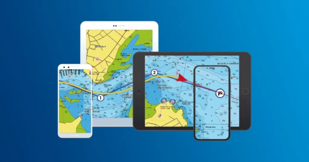
Marine navigation apps have revolutionized how sailors and boaters plan their journeys, particularly in tracking tides and currents. These natural forces significantly determine a boat’s safety, speed, and efficiency at sea. By offering real-time data, tide charts, and other valuable features, marine navigation apps have become essential tools for anyone navigating the waters. Here’s how these apps help track tides and currents and why understanding these elements is crucial.
The Importance of Tracking Tides and Currents
Understanding Tides
Tides are the rise and fall of sea levels, influenced primarily by the moon’s and the sun’s gravitational pull. They happen twice daily, and knowing when the tide is high or low is critical for several reasons:
- Safe Docking and Anchoring: If you don’t know the tide times, you risk grounding your boat or struggling to dock in shallow waters.
- Fuel Efficiency: Properly timing your departure with favorable tides can help reduce drag and conserve fuel.
- Navigating Shallow Waters: Knowing the tides ensures you can safely pass through channels and inlets, avoiding grounding in shallow waters.
Understanding Currents
Currents are the continuous movement of water, which can either help or hinder your boat’s progress. Tracking currents is just as important as tracking tides, as currents can significantly impact:
- Speed and Direction: When sailing with the current, your boat moves faster and uses less fuel. Against the current, you may face resistance and increased fuel consumption.
- Safety: Strong currents can make docking or maneuvering through tight spaces difficult and even dangerous.
How Marine Navigation Apps Track Tides and Currents
Marine navigation apps offer real-time, comprehensive information to help sailors make smart decisions regarding tides and currents. Here’s how these apps work to provide essential data.
1. Real-Time Data
One of the most valuable features of modern marine navigation apps is the ability to provide real-time data on tides and currents. These apps pull data from global networks of tide stations, satellite information, and weather buoys. This continuously updates data, allowing sailors to make informed decisions based on current conditions.
Real-time updates are especially helpful when weather or ocean conditions change unexpectedly. For example, if you’re in an area known for swift tidal changes, real-time data can help you avoid problems like running around.
2. Predictive Tide Charts
Most marine navigation apps also offer predictive tide charts, which provide a forecast of tide levels over a set period, usually hours or days. These charts are invaluable for planning longer trips, especially when crossing through areas with fluctuating water levels. By knowing when high or low tide will occur, boaters can adjust their sailing schedules accordingly.
For instance, if you’re planning to pass through a narrow channel, a predictive tide chart can show you the best time to ensure you sail during high tide to avoid the risk of running aground.
3. Custom Alerts and Notifications
Marine navigation apps often allow users to set custom alerts and notifications to help sailors stay on top of the tide and current changes. You can receive reminders or warnings about upcoming low tides, strong currents, or sudden changes in weather conditions. This feature ensures you’re always prepared, even if you’re not actively monitoring the app during your journey.
4. Integration with Other Navigation Tools
Marine navigation apps often integrate with GPS, radar, and weather forecasting systems. This comprehensive combination gives sailors a complete overview of the conditions at sea. The ability to overlay tide and current data on top of a navigational map ensures safer and more efficient travel.
By seeing how the tides and currents will interact with your planned route, you can make real-time adjustments, like altering your speed or changing your course to take advantage of favorable conditions.
Benefits of Using Marine Navigation Apps for Tracking Tides and Currents
1. Enhanced Safety
Tracking tides and currents in real-time is crucial for avoiding hazards like running aground or getting caught in strong currents. Marine navigation apps enhance safety by providing up-to-date information, ensuring boaters can make the best decisions based on current conditions.
2. Fuel Efficiency
Planning your trip based on tidal movements and favorable currents can save fuel by reducing resistance and drag. Knowing when to depart can also optimize fuel usage and make your journey more efficient.
3. User-Friendly Interface
Marine navigation apps are designed with ease of use in mind. They offer simple charts, maps, and data streams that make it easy for novice and experienced sailors to track tides and currents without confusion.
Conclusion
Marine navigation apps are indispensable tools for tracking tides and currents, ensuring safe, efficient, and enjoyable boating experiences. These apps are invaluable for anyone planning a trip on the water by offering real-time data, predictive charts, and easy-to-use interfaces. When paired with other essential tools like marine radios, marine navigation apps help sailors navigate confidently, keeping them informed and safe throughout their journey.
